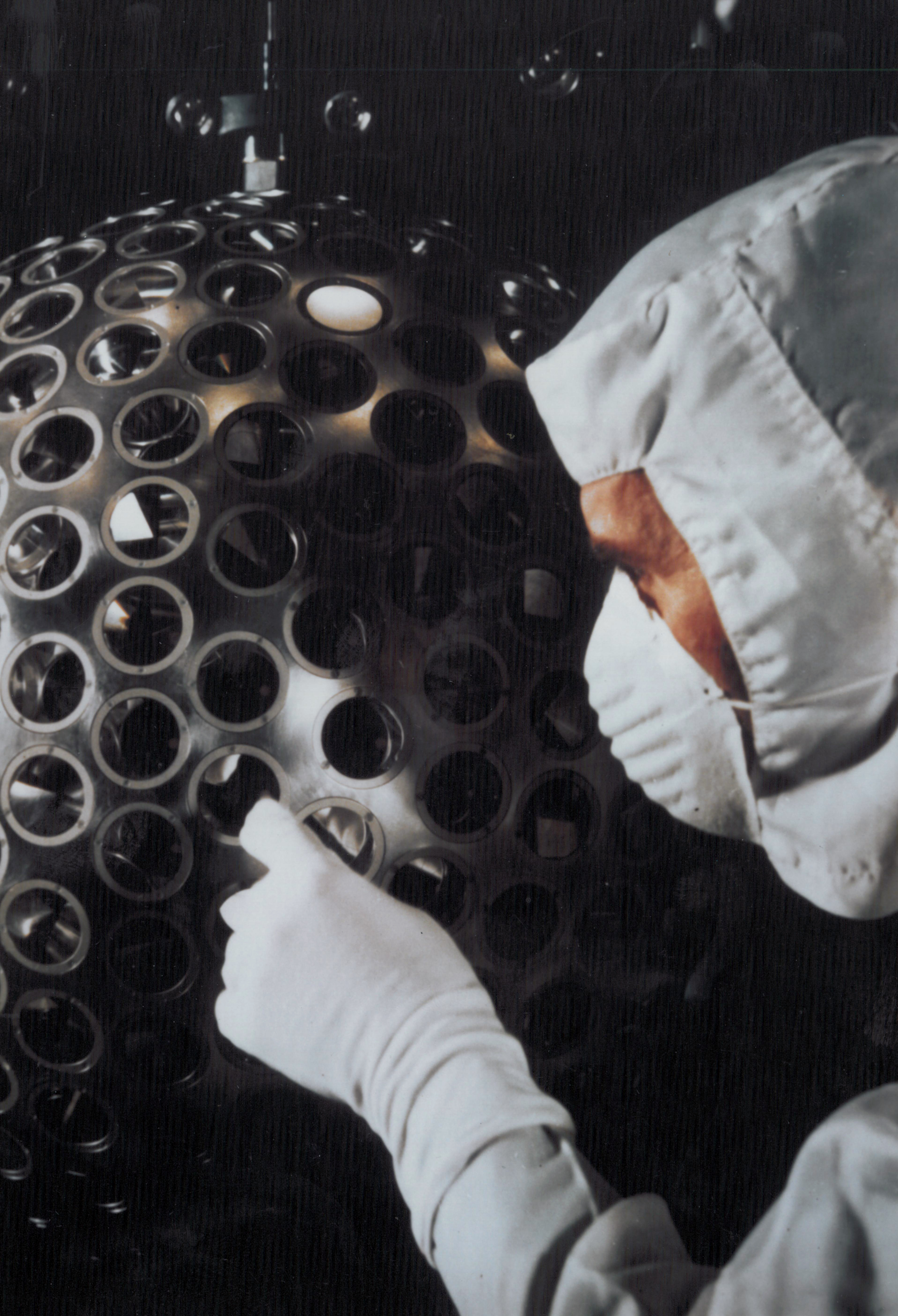
NASA's LAGEOS satellite, launched in 1976, remains one of the most precise tools for tracking Earth's movement and structural changes. The 60-centimeter sphere orbits 6,000 kilometers above Earth, equipped with 426 retroreflectors that reflect laser signals from ground stations back to their source with extraordinary accuracy.
Ground-based observatories worldwide fire laser pulses at LAGEOS and measure the precise time for the signal to bounce back. These measurements, accurate to within centimeters, reveal how Earth's crust moves and deforms. Scientists use the data to monitor continental drift, detect crustal strain that precedes earthquakes, and track changes in Earth's rotation.
The satellite's high orbit and passive design—no onboard electronics required—ensure longevity. LAGEOS operates today essentially as it did nearly five decades ago. A second satellite, LAGEOS 2, launched in 1992 to increase measurement density across different latitudes.
The retroreflector technology allows ground stations to determine LAGEOS's position to within 2 centimeters despite the satellite orbiting at 16,000 kilometers per hour. This enables detection of millimeter-scale ground movements over time. Researchers have used LAGEOS data to understand postglacial rebound, where land previously compressed under ice sheets slowly rises. The mission also contributes to International Laser Ranging Service networks that support fundamental physics experiments, including tests of general relativity.
LAGEOS demonstrates how simple, elegantly designed space hardware can deliver decades of scientific returns. The mission requires no fuel, no maintenance, no commands. It simply reflects. This passive approach has allowed continuous, uninterrupted Earth science measurements that would be impossible with ground-based instruments alone. Modern geodetic networks still depend on LAGEOS observations alongside newer GPS and GNSS systems, making it an irreplaceable