Hawaii's Kīlauea volcano erupted on June 17, 2026, marking the 49th documented eruption of the volcanic system. Satellites captured the event from orbit, documenting the lava fountaining and thermal signatures of one of Earth's most active volcanoes.
Kīlauea sits atop the Hawaiian hotspot, a region of intense geothermal activity where magma rising from Earth's mantle repeatedly breaches the surface. Each eruption provides volcanologists with fresh data on magma composition, degassing rates, and crustal deformation. Space-based thermal imaging instruments detect heat signatures that ground-based monitoring cannot reach, particularly during active lava effusion.
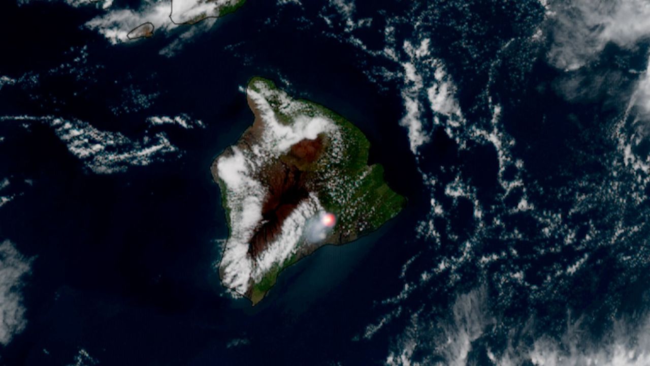
The satellite imagery reveals what ground observers and seismic networks cannot fully capture in isolation. Thermal infrared sensors measure surface temperature changes across the volcanic edifice, while visible-wavelength cameras document the extent and direction of lava flows. These observations feed directly into hazard assessment models that Hawaii's Volcano Disaster Assistance Program uses to protect nearby communities.
Kīlauea's frequent activity makes it a natural laboratory for understanding Hawaiian volcanism. The volcano's shallow magma chamber and relatively accessible summit crater have allowed scientists to track eruption mechanics for decades. Each new eruption adds another data point to models explaining how hotspot volcanism works, information applicable to volcanic regions worldwide.
The 49 known eruptions represent only a fraction of Kīlauea's actual activity. The volcano erupted continuously from 1983 to 2018, a 35-year stretch interrupted by brief pauses. Since 2020, it has entered a pattern of episodic eruptions separated by months or years of quiescence. Orbital monitoring enables researchers to detect the onset of activity even in remote volcanic regions, advancing our ability to forecast eruptions and understand how planetary geology