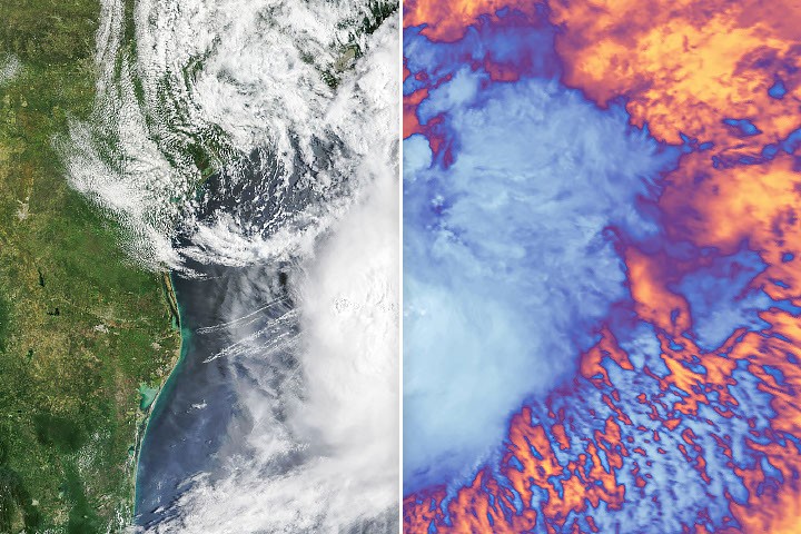
Tropical Storm Arthur formed as the opening system of the 2026 Atlantic hurricane season, delivering heavy precipitation and flood risks across the U.S. Gulf Coast. NASA monitored the storm's development and behavior using satellite instruments that track atmospheric moisture, cloud patterns, and precipitation rates in real time.
Weather monitoring from space provides meteorologists with continuous data on storm intensity, movement, and rainfall potential. NASA's Earth-observing satellites, including those in the Landsat and MODIS programs, capture visible and infrared imagery that reveals cloud structure and convective patterns. This information feeds directly into National Weather Service forecasts and public warnings.
Arthur's arrival early in the 2026 season signals ongoing patterns in Atlantic tropical cyclone activity. Climate models suggest warming ocean temperatures and atmospheric conditions continue to influence storm formation and track prediction. Satellite-based precipitation measurements help forecasters estimate rainfall accumulation and issue flash flood watches for vulnerable coastal regions.
The Gulf Coast remains particularly susceptible to storm surge and inland flooding from tropical systems. Real-time data from NASA satellites enables emergency managers to issue timely evacuations and prepare response infrastructure. Rainfall estimates derived from satellite radar help communities understand which areas face the highest inundation risk.
Understanding tropical storm behavior through space-based observation strengthens forecasting accuracy and public safety measures. Arthur's tracking and analysis contribute to the broader dataset that researchers use to study how Atlantic hurricane seasons develop and evolve. Each storm provides fresh observational data on precipitation processes, wind shear effects, and moisture dynamics in the lower atmosphere.