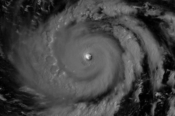
NASA satellites tracked Super Typhoon Bavi as the third Category 5 tropical cyclone to form in 2026, marking an exceptional year for intense Pacific storm activity. The system crossed the U.S. Northern Mariana Islands and Guam before advancing toward Asia, bringing destructive winds and flooding to populated regions in its path.
NASA's Earth observation network captured real-time data on Bavi's intensity and trajectory using instruments aboard satellites like GOES-16 and Himawari-8. These platforms monitor atmospheric pressure, cloud formations, and sea surface temperatures that drive rapid intensification in tropical cyclones. The 2026 season's three Category 5 storms represent an uptick in the most severe tropical cyclones, a pattern consistent with climate models predicting more intense hurricanes and typhoons as ocean temperatures rise.
Bavi's passage through the Mariana Islands and Guam posed direct threats to military installations, civilian infrastructure, and communities across the western Pacific. The U.S. territory of Guam, home to critical naval and air force bases, faces repeated exposure to typhoons. NASA data supports disaster preparedness efforts by providing forecasters with precise storm positioning and intensity measurements hours before impact.
The transition toward Asia placed densely populated coastal regions in Vietnam, the Philippines, and China in potential danger zones. Super typhoons of this magnitude generate storm surges exceeding six meters, rainfall totals surpassing 300 millimeters in 24 hours, and sustained winds above 150 knots. Such conditions trigger landslides, destroy agricultural systems, and displace entire communities.
NASA's role extends beyond immediate tracking. Satellite observations help scientists understand how climate change alters tropical cyclone behavior, including changes in storm duration, forward speed, and precipitation rates. The accumulation of 2026 data contributes to long-term climate assessment and in