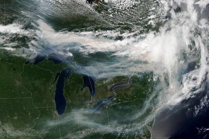
NASA satellite imagery tracked massive smoke plumes from Canadian wildfires crossing Ontario and Quebec, with the haze extending into the U.S. Midwest and Northeast regions. The space agency's Earth observation sensors captured the sprawling phenomenon as smoke traveled eastward across the continent.
Satellite instruments provided real-time monitoring of the smoke's movement and density, allowing atmospheric scientists to track air quality impacts across multiple states and provinces. NASA's Earth Observing System satellites, equipped with sensors like the Moderate Resolution Imaging Spectroradiometer (MODIS), detected the aerosol concentrations and their optical properties as the smoke dispersed.
Wildfire smoke contains particulate matter and gases that degrade air quality downwind of the fire source. The satellite data helps environmental agencies issue air quality alerts and health advisories for affected populations. Ground-based air quality monitors supplement the space-based observations, creating a comprehensive picture of smoke transport through the atmosphere.
NASA's monitoring capabilities prove essential during wildfire season, when smoke from regional fires can travel hundreds of miles and impact air quality for millions of people. The agency's Earth science missions provide continuous observation of atmospheric conditions, enabling researchers to understand how smoke patterns evolve and disperse over time.
The data collected during events like this wildfire smoke plume contributes to climate research and air quality forecasting models. Better understanding of smoke transport improves prediction accuracy for future events, helping communities prepare for degraded air quality conditions.