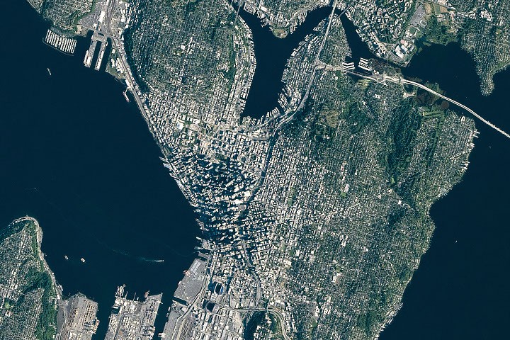
Glaciers carved Seattle's topography over millennia, leaving behind the Puget Sound basin and the city's distinctive hills. NASA scientists studying the region's geological history use satellite imagery and terrain analysis to map how ice age glaciation shaped the Pacific Northwest landscape.
The Vashon Glaciation, the most recent major ice advance, ended roughly 14,000 years ago. Continental ice sheets kilometers thick ground through the terrain, excavating deep basins that later filled with water to form Puget Sound and Lake Washington. Drumlin formations, elongated hills aligned with glacial flow direction, remain visible across the landscape today.
Human modification has significantly altered Seattle's natural geography. The city's early development relied on regrading projects that physically moved entire hillsides. Pioneer Square and surrounding neighborhoods were built on artificially lowered terrain. Lake Washington's water level was lowered by approximately seven meters in 1917 through construction of the Ballard Locks and Ship Canal, fundamentally changing the aquatic ecosystem and human settlement patterns.
NASA's remote sensing capabilities reveal these layered geological and anthropogenic changes. Satellite data tracks current landscape dynamics, including ground subsidence in some areas and the ongoing impacts of urbanization on natural drainage systems. Understanding Seattle's geological foundation informs infrastructure planning, earthquake hazard assessment, and climate adaptation strategies for the region.
The Seattle landscape represents a palimpsest of natural forces and human intervention. Glacial legacy and urban development interact in ways that shape current environmental challenges and future planning decisions. Scientists studying these interactions gain insights applicable to other glaciated regions worldwide experiencing rapid urbanization and climate change.