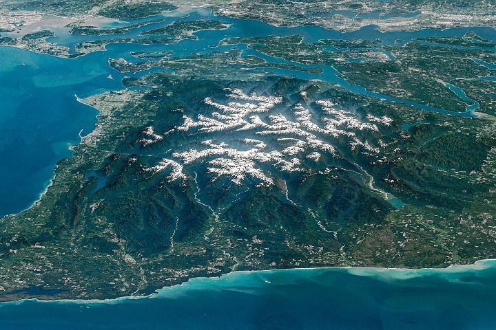
NASA's Earth observation satellites have captured stunning imagery of the Olympic Mountains in northwestern Washington, revealing geological formations sculpted over millions of years by relentless erosion and glaciation. The snow-capped peaks and deep river valleys visible in the satellite data showcase how water and ice reshape landscapes across timescales humans rarely witness directly.
The Olympic Range spans roughly 80 miles and reaches elevations above 7,900 feet at its highest point, Mount Olympus. Satellite instruments detect the mountain's snow and ice coverage, providing scientists with crucial data about seasonal changes, glacial retreat patterns, and water availability for downstream communities. NASA's Earth imaging capabilities, including sensors aboard Landsat and other spacecraft, document these changes year over year, creating a baseline for understanding regional climate impacts.
Deep river valleys cutting through the mountains reveal the work of ancient glaciers and modern water erosion. These valleys funnel snowmelt and rainfall toward the Pacific Northwest's rivers and streams, systems vital to salmon populations and regional ecosystems. Remote sensing data helps hydrologists track water flows and predict seasonal water availability for agriculture, power generation, and municipal use.
The Olympic Mountains sit within the Olympic National Forest and National Park, a region of exceptional biological diversity. NASA's Earth observation platforms help resource managers monitor forest health, track vegetation changes, and detect wildfire risk in real time. Scientists use multispectral imaging to distinguish between healthy forests, areas experiencing drought stress, and burned regions.
The snow-capped appearance captured in NASA imagery reflects winter conditions typical of the Pacific Northwest's maritime climate. Seasonal snow accumulation and melt cycles influence everything from river discharge patterns to alpine ecosystem timing. Continued satellite monitoring provides evidence for understanding how changing climate patterns affect these critical mountain systems.
Earth observation data transforms abstract climate models into concrete, visible change. When scientists track the Olympic Mountains' snow extent from year to year or monitor vegetation patterns across seasons,