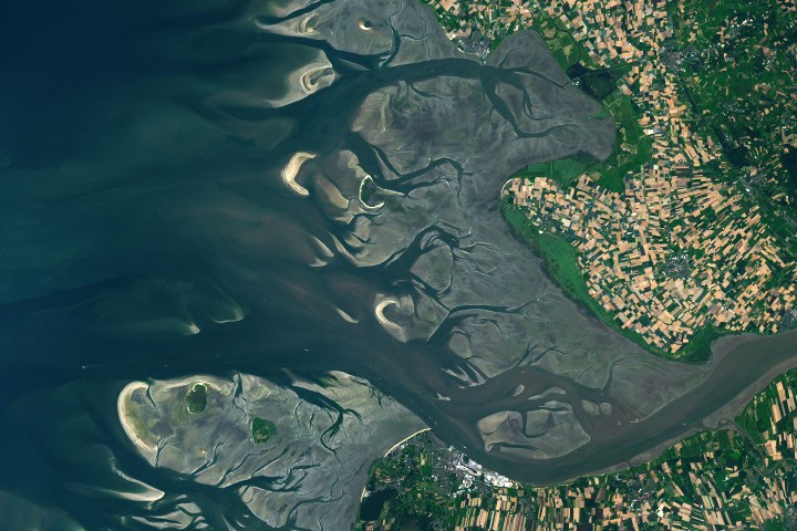
NASA satellite imagery captured the dramatic interplay of tidal forces along Germany's Elbe River estuary, revealing how water movement sculpts coastal geography. The Operational Land Imager aboard Landsat 8 documented the contrast between high and low tide at the river mouth, showing how 12 hours of tidal shift transforms exposed mudflats into submerged channels.
The Elbe estuary hosts one of Europe's busiest ports at Hamburg, making tidal prediction essential for maritime operations. Container ships and bulk carriers navigate through channels that shift with lunar cycles and seasonal runoff. Tidal flats exposed at low tide display distinct sediment patterns—lighter sandy areas alternate with darker mud banks—creating a natural record of water movement.
NASA's Earth observation satellites track these coastal dynamics by measuring water levels and sediment distribution across multiple passes. The data reveals how tidal energy moves sediment downstream toward the North Sea, reshaping the estuary's topography over years and decades. Understanding these patterns helps port authorities optimize shipping schedules and dredging operations.
The Elbe estuary represents a convergence zone where river discharge meets Atlantic tidal forces. Fresh water from upstream mixes with salt water, creating a brackish environment that supports specialized ecosystems. Wading birds, fish species, and other wildlife depend on the predictable exposure and submersion of tidal flats for feeding and breeding.
Satellite monitoring of tidal flats serves dual purposes. Port operators gain data for navigation safety and efficiency. Coastal scientists track long-term changes in sediment transport and estuary health. Climate shifts alter both freshwater input and sea-level rise, factors that reshape tidal dynamics over time.
The Elbe's tidal signature—visible from space through color and texture variations—exemplifies how Earth observation reveals processes invisible from the ground. Regular satellite passes create a continuous archive documenting how oceans