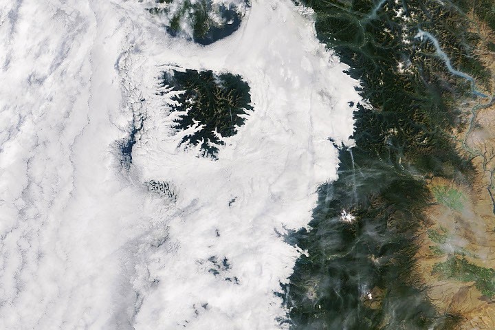
# Cloudy Cloak Over the Northwest
NASA satellites captured a striking atmospheric phenomenon across the Pacific Northwest in autumn, revealing how marine stratocumulus clouds create distinct layers of weather over coastal terrain. The observation demonstrates the agency's Earth-monitoring capabilities and the complex interactions between ocean, land, and atmosphere in North America's western regions.
Low-lying cloud formations settled over western Washington and Oregon, blanketing the lowlands in thick gray cover while mountainous zones near the coast pierced through the cloud deck like islands in a sea of mist. This layered cloud structure forms when moist marine air encounters the dramatic topography of the Cascade Range and coastal peaks, creating a visual separation between cloud-shrouded valleys and sun-exposed ridges.
The phenomenon NASA documented reflects standard autumn weather patterns for the region. As ocean temperatures cool and atmospheric conditions shift toward fall, marine air masses transport moisture inland. When this air encounters elevated terrain, it cools and condenses, forming stratocumulus clouds that pool in lower elevations. Higher peaks, reaching above the cloud layer's altitude, experience clear conditions while surrounding lowlands remain obscured.
NASA's Earth observation satellites captured this scene with infrared and visible-light sensors that distinguish cloud tops, atmospheric layers, and surface temperature variations. These observations serve multiple purposes beyond weather documentation. Scientists use such imagery to refine climate models, validate weather prediction algorithms, and study how regional topography influences cloud formation and distribution. Understanding these atmospheric mechanics helps meteorologists improve forecasting accuracy for Pacific Northwest residents and agricultural operations.
The mountain-cloud interaction visible in this NASA image illustrates principles that apply globally. Coastal mountain ranges worldwide, from the Andes to the Western Ghats, create similar layering effects. By studying these patterns, atmospheric scientists develop better frameworks for predicting regional weather variations and assessing how changing climate conditions might alter precipitation distribution across terrain-dominated landscapes.
NASA's Earth Observing System, which includes satellites like Landsat 8 and the NOAA-operated GOES satellites, continuously monitors such atmospheric conditions. This persistent observation capability enables scientists to track how autumn transitions unfold across North America and identify variations from historical norms. Data from these missions feeds into weather services, climate research, and water resource planning.
The visual record of this phenomenon also holds value for public outreach. Satellite imagery makes atmospheric science tangible and immediate. When residents of the Pacific Northwest see their own region captured from space, with cloud patterns matching their ground-level experience of hazy mornings and clear mountaintop afternoons, the connection between satellite data and daily weather becomes concrete.
Autumn cloud formations like this occur repeatedly throughout fall and early winter in the region. Each occurrence provides another data point for validating atmospheric models and refining understanding of seasonal transitions. As climate patterns shift globally, tracking these recurring phenomena becomes increasingly valuable for detecting long-term trends in regional weather behavior and cloud behavior.