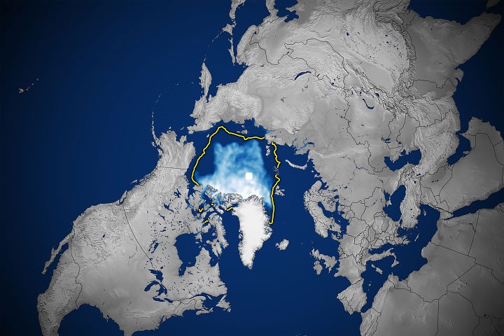
Arctic sea ice has declined to its 2026 minimum, according to satellite records from NASA. The data reveals that Arctic sea ice coverage has contracted in both winter and summer seasons, marking continued losses in the polar region.
Satellite observations document the shrinking extent of sea ice across the Arctic Ocean. The minimum represents the lowest point reached this year in the annual cycle of Arctic ice melt and refreezing. NASA's monitoring systems track these changes through dedicated satellite instruments that measure ice coverage across the Arctic region.
The decline in Arctic sea ice occurs during both seasonal cycles. Winter ice extent, typically the year's maximum, has decreased compared to historical records. Summer ice extent, normally the seasonal low point, has also contracted. These dual seasonal decreases underscore a broader pattern in Arctic ice dynamics.
Satellite records provide consistent measurement of Arctic sea ice extent over multiple decades. These instruments detect the boundary between ocean and ice, allowing researchers to quantify changes in coverage area. The data enables tracking of trends across years and decades.
The Arctic represents a critical region for global climate systems. Sea ice changes in the polar north influence atmospheric and oceanic circulation patterns. Satellite monitoring continues to document these transformations as they occur.