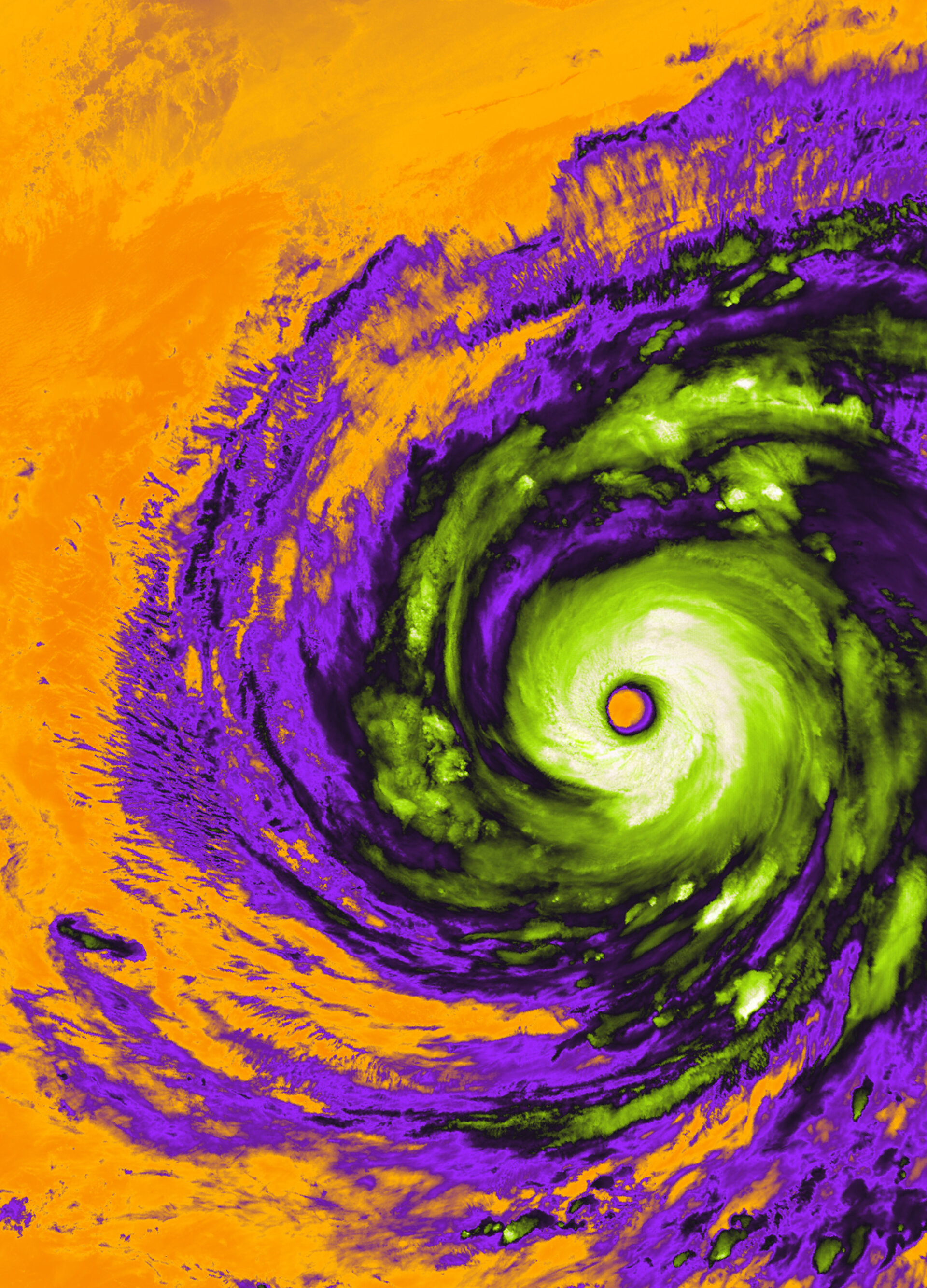
The Copernicus Sentinel-3 satellite captured an image of Super Typhoon Champi on October 21, 2026, off the coasts of Taiwan and the Philippines. The storm's eye spans approximately 50 km across.
Champi ranks as the strongest tropical cyclone recorded so far this year, with maximum sustained winds of 296 km per hour. The Sea and Land Surface Temperature Radiometer aboard Sentinel-3 recorded the storm using thermal infrared wavelengths, measuring brightness temperature rather than actual temperature.
The false-colour image assigns distinct colours to brightness temperatures. Green, white and light grey areas show cold clouds at the storm's centre, with cloud-top temperatures as low as minus 70 degrees Celsius. Purple areas represent clouds with temperatures between minus 30 and minus 15 degrees Celsius. Orange areas indicate temperatures over ocean and land, averaging about 25 degrees Celsius.
The image illustrates how cold clouds moving over warm ocean fuel the typhoon's intensity. Champi brought serious flooding and damage across eastern Taiwan and generated waves up to 10 metres near the storm's centre.