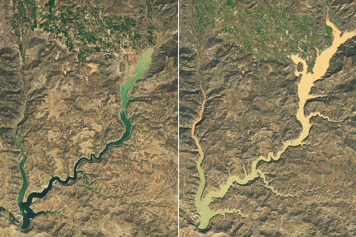
Back-to-back extreme rain events struck the Four Corners region of the U.S. Southwest in late October and early November 2026, causing water levels in Navajo Reservoir to rise nearly 60 feet in about six weeks. Landsat 9's Operational Land Imager captured the rapid transformation, with satellite images from September 20 and November 7 showing the dramatic change in the lake's surface area. By November 7, the reservoir in northern New Mexico and southern Colorado reached its highest level since August 2019 and stood at 108 percent of average capacity for that date, up from 60 percent on September 20, according to U.S. Army Corps of Engineers data.
The torrential rainfall, totaling 2 to 4 times the average across the Four Corners region through early November, ended short-term drought conditions but triggered damaging floods. The San Juan River and other tributaries swelled with runoff. Pagosa Springs, Colorado, experienced severe flooding after receiving 5.05 inches of rain, with the San Juan River reaching major flood stage on October 23 and nearly matching a 1911 record level on November 1. Responders rescued dozens of people as officials issued evacuation orders.
The unusually active pattern reflected El Niño conditions strengthening the jet stream near the equatorial Pacific. Experts noted that the low-pressure system delivering the rainfall operated at an unusually low latitude and drew energy from abnormally high ocean temperatures. The extreme wet weather provided relief after snow drought and high temperatures had limited spring snowmelt in winter 2025-26.