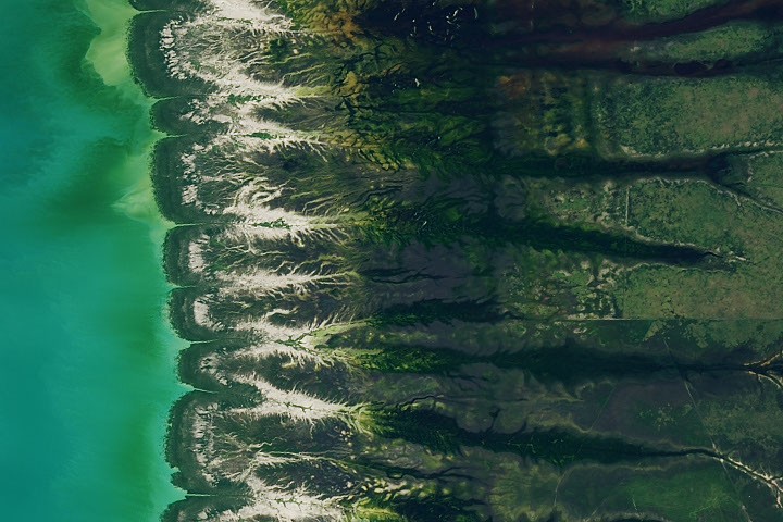
NASA Earth Observatory imagery reveals the dynamic seasonal patterns of Roebuck Bay, a crescent-shaped estuary along Western Australia's remote Kimberley coast. The bay's striking productivity stems from its unique tidal regime and seasonal river discharge, creating a natural laboratory for understanding coastal oceanography.
Roebuck Bay experiences some of the world's most extreme tidal ranges, with water levels fluctuating up to 11 meters between high and low tide. These powerful tidal movements churn nutrients from the seafloor into surface waters, fueling blooms of phytoplankton visible in satellite imagery as swirling patterns of sediment and organic matter. During seasonal monsoon periods, freshwater discharge from inland rivers further alters water color and nutrient distribution across the bay's surface.
The bay's crescent geometry amplifies tidal effects. Funnel-shaped topography concentrates tidal energy, accelerating water movement and creating the conditions for exceptional biological productivity. This drives a food web that supports vast populations of fish, crustaceans, and migratory birds. Indigenous Australians of the Yawuru people have harvested these resources sustainably for thousands of years, relying on detailed knowledge of the bay's rhythms.
NASA's Earth observation satellites, including Landsat and the Moderate Resolution Imaging Spectroradiometer (MODIS), track these monthly and seasonal changes in real time. The false-color imagery captures variations in sediment concentration and water chemistry that reveal invisible oceanographic processes. Red and brown hues indicate suspended sediment plumes, while blues mark clearer offshore waters.
Understanding coastal systems like Roebuck Bay helps scientists model how climate change affects tidal ecosystems globally. Rising sea levels, shifting monsoon patterns, and ocean acidification pose direct threats to these highly specialized environments. The bay's exceptional productivity makes it a sentinel system for