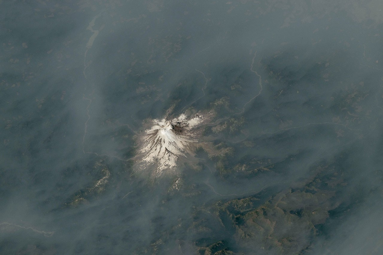
Astronauts aboard the International Space Station captured striking imagery of the Cascade Range during summer 2026, documenting Mount Hood in Oregon and Mount Rainier in Washington as wildfire smoke engulfed the Pacific Northwest region. The photographs, taken from the orbiting laboratory roughly 250 miles above Earth's surface, reveal the extent of smoke plumes spreading across the landscape, creating a visceral record of environmental conditions during an active fire season.
The ISS provides a vantage point unavailable from ground-level observation. Astronauts conducting Earth observation work from the station's Cupola module and external platforms photograph natural disasters, climate patterns, and environmental changes with clarity impossible to achieve from terrestrial sensors alone. These images serve dual purposes: documenting real-time conditions and validating data collected by specialized Earth observation satellites operated by NASA, NOAA, and international partners.
Mount Rainier and Mount Hood stand among the Pacific Northwest's most prominent volcanic peaks. Mount Rainier reaches 14,410 feet and sits atop the Cascade volcanic arc, a chain of stratovolcanoes stretching from northern California through Washington. Mount Hood rises to 11,249 feet in Oregon's portion of the range. Both volcanoes maintain snow and glacial ice year-round, yet the 2026 imagery shows how atmospheric smoke can obscure even these major geographic landmarks, illustrating the scale of wildfire activity affecting the region.
Wildfire smoke carries significant implications for atmospheric science and air quality monitoring. When NASA astronauts photograph smoke events from the ISS, they document aerosol distributions that influence solar radiation, cloud formation, and regional climate patterns. These observations complement space-based instruments like the Moderate Resolution Imaging Spectroradiometer (MODIS) aboard NASA's Terra and Aqua satellites, which track aerosol optical depth and fire detection continuously.
The Pacific Northwest experiences seasonal fire activity driven by summer drought conditions, temperature patterns, and fuel accumulation in forests. The 2026 event captured from the ISS reflects broader trends in regional fire ecology and climate variability. Smoke plumes from western wildfires frequently transport pollutants across state and national boundaries, affecting air quality in distant population centers.
Photography from the ISS serves as a powerful communication tool for understanding Earth system dynamics. When astronauts document environmental phenomena, those images reach policymakers, scientists, and the public with an immediacy that satellite data alone cannot match. The human perspective from orbital altitude emphasizes the interconnectedness of geographic systems and the scale of environmental challenges.
The International Space Station operates as a laboratory for Earth observation, hosting instruments and human observers who study atmospheric phenomena, land use changes, and natural hazards. Crew members rotate through expeditions lasting approximately six months, and each mission includes dedicated Earth observation sessions. The images of Mount Hood and Mount Rainier shrouded in smoke represent routine but essential documentation of how wildfire activity reshapes the visible landscape at continental scale.