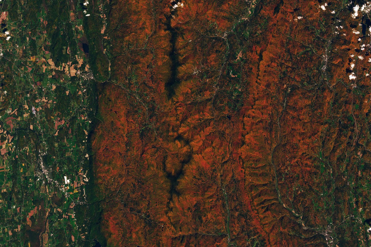
# Hunting Red Leaves with Satellites
NASA satellites now enable scientists and nature enthusiasts to track autumn foliage across North America with unprecedented precision, transforming the centuries-old tradition of leaf-peeping into a data-driven pursuit.
The technology relies on NASA's Earth-observing satellites, which measure how plants reflect light across different wavelengths. During autumn, trees stop producing chlorophyll, revealing hidden pigments like anthocyanins and carotenoids that paint leaves red, orange, and yellow. Satellites detect these color changes through spectral analysis, mapping the progression of peak foliage across entire regions day by day.
NASA's Landsat satellites and the Moderate Resolution Imaging Spectroradiometer (MODIS) instrument aboard the Terra and Aqua satellites provide the backbone of this capability. MODIS captures visible and infrared imagery at resolutions allowing scientists to distinguish vegetation changes across landscapes. Landsat, operating since 1972, offers finer spatial detail that reveals foliage conditions at neighborhood scale. Together, these instruments create a continuous record of phenological change, the study of seasonal biological events.
The applications extend beyond recreational planning. Scientists use satellite-based foliage tracking to understand how climate change alters the timing and intensity of autumn colors. Earlier springs advance leaf emergence. Warmer falls can delay the onset of dormancy. These shifts ripple through ecosystems, affecting insects, birds, and other wildlife dependent on precise seasonal windows for migration and reproduction.
Researchers at universities and NASA centers now produce real-time foliage forecasts that rival traditional prediction models. The satellite data captures what ground-based observers cannot: the nuance of color change across thousands of square kilometers simultaneously. A warm spell in October can halt the progression of red leaves for days. An early frost accelerates the transition. Satellites record these dynamics as they unfold.
The Northeast has become a focal point for this science. Deciduous forests spanning New England and the Mid-Atlantic generate billions in tourism revenue annually as visitors seek peak foliage. Accurate forecasting using satellite data helps parks, resorts, and tourism boards prepare for visitation surges. Leaf-peepers who time their trips based on satellite-derived predictions arrive when trees display their most vibrant colors.
NASA also collaborates with the U.S. Geological Survey and universities to integrate satellite observations with ground measurements. Researchers place sensors on trees to measure leaf pigment concentrations, then cross-reference the data with satellite reflectance signatures. This ground-truthing improves the accuracy of remote sensing algorithms.
The Visible Earth website and similar NASA platforms now offer weekly foliage maps available to the public. Users can track color change progression across states and plan trips accordingly. Education initiatives bring this technology into classrooms, teaching students how satellites monitor Earth's biosphere.
This convergence of ancient tradition and modern Earth observation demonstrates how space technology serves immediate practical needs while advancing climate science. As global temperatures shift, tracking phenological changes becomes increasingly valuable for understanding ecosystem health and resilience. Satellites watching autumn colors transform provide real data about how quickly our planet adapts to warming conditions. That knowledge shapes conservation strategies and policy decisions for decades to come.