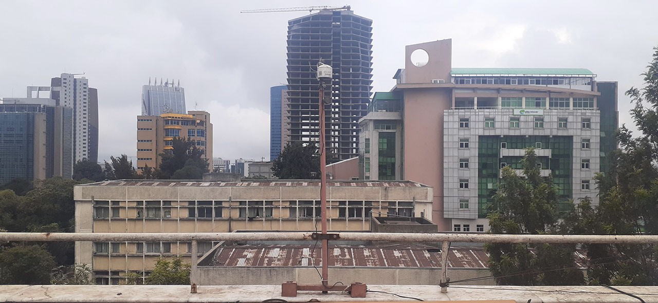
NASA's Multi-Angle Imager for Aerosols (MAIA) has deployed ground sensors across Addis Ababa, Ethiopia's capital, to measure air pollution with unprecedented precision. One of ten roof-mounted instruments positioned throughout the city, these sensors track particulate matter smaller than 2.5 micrometers in diameter, known as PM2.5. This pollution type ranks among the deadliest environmental hazards globally, linked to respiratory disease, cardiovascular damage, and premature death.
MAIA represents a NASA-led effort to bridge a critical gap in air quality monitoring. While satellites have long tracked aerosols from space, they cannot reliably measure ground-level pollution where people actually breathe. The instruments deployed in Addis Ababa feed direct validation data to the MAIA satellite instrument, which launched aboard the International Space Station in 2022. By comparing what the satellite observes with what ground sensors record, researchers calibrate and refine orbital measurements across regions where air quality data remains scarce.
Addis Ababa serves as a crucial testing ground. The city experiences acute seasonal air quality challenges driven by dust storms, vehicle emissions, and industrial activity. With 3.4 million residents, the metropolitan area faces real public health pressure from poor air quality. Yet Ethiopia, like much of sub-Saharan Africa, has limited ground-based monitoring infrastructure. This gap matters enormously. Without reliable data, governments cannot establish health protections, urban planners cannot design interventions, and vulnerable populations remain invisible in global air quality assessments.
The MAIA mission addresses this asymmetry directly. The satellite's multi-angle viewing capability allows it to distinguish aerosol types and measure atmospheric properties that single-perspective instruments cannot detect. By observing the same air mass from multiple angles, MAIA characterizes whether particulates are sea salt, dust, smoke, or pollution-generated sulfates. This compositional data proves essential for understanding health impacts, since not all PM2.5 carries equal risk.
The ten sensors in Addis Ababa deploy laser scattering technology to measure particle concentration in real time. Data flows continuously, creating a validation dataset that transforms MAIA's satellite observations from global coverage into actionable local intelligence. This feedback loop strengthens the entire system. As the satellite instrument improves its algorithms, coverage expands to regions previously lacking reliable aerosol measurements.
Ethiopia's deployment reflects MAIA's broader strategy. The mission operates validation sites in other air-quality hotspots including India, China, and the Middle East. These locations concentrate where pollution levels threaten public health most acutely and where satellite data integration can drive policy impact fastest.
The MAIA ground network also supports Ethiopia's environmental monitoring capabilities directly. Data access flows to Ethiopian research institutions and government agencies, building local scientific capacity and informing air quality regulations. As cities across Africa urbanize rapidly, reliable aerosol monitoring becomes foundational to environmental health policy.
The Addis Ababa deployment demonstrates how space-based observation requires ground truth. Satellites alone cannot protect human health. They provide the geographic scope, but sensors at the street level provide the verification that makes space data trustworthy and actionable for the people who live beneath polluted skies.