# NASA's August 2026 Satellite Imagery Challenge Invites Public Detection Skills
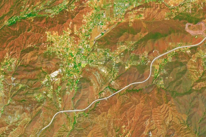
NASA released satellite imagery in August 2026 asking the public to identify a mysterious location and explain its scientific or geographic significance. The agency's ongoing "satellite puzzler" program enlists citizen observation to test Earth-monitoring capabilities and engage audiences with remote sensing applications.
The puzzler format presents orbital imagery of an unnamed terrestrial location, challenging participants to recognize geographic features, landmarks, or natural phenomena visible from space. Success requires familiarity with satellite image interpretation, understanding of Earth's diverse landscapes, and knowledge of what makes particular regions geologically, ecologically, or culturally distinctive. NASA's Earth Observatories and satellite platforms including Landsat and Sentinel missions collect the raw data for these challenges.
These puzzles serve dual purposes within NASA's public engagement strategy. First, they demonstrate the practical utility of Earth observation satellites for monitoring climate, weather, land use, and natural disasters. Second, they build public literacy around remote sensing technology, helping citizens understand how orbital instruments detect features invisible to ground-level observers. The challenges highlight capabilities of NASA's fleet of Earth-monitoring spacecraft, which track everything from ocean temperatures to vegetation health to urban expansion.
The August 2026 edition asked participants to locate the site and articulate what distinguishes it. Potential answers might reference geological formations like calderas or canyons, hydrological features like glacial valleys or salt lakes, urban infrastructure patterns, agricultural configurations, or ecosystem boundaries visible through spectral analysis. Seasonal variations in vegetation or water levels often provide critical clues. The puzzles occasionally highlight regions undergoing rapid change, allowing NASA to underscore how satellites document environmental transitions.
Participation mechanisms typically involve NASA's citizen science platforms or social media channels where the public submits location guesses and explanations. Correct answers often reveal locations of active research interest to NASA scientists. A puzzler might spotlight a volcano scientists monitor for eruption risk, an ice sheet region tracked for climate change indicators, a river system experiencing flooding patterns, or a desert region showing changing vegetation due to drought or precipitation shifts.
These interactive challenges connect satellite technology to tangible Earth applications. When participants successfully identify a location from orbital perspective alone, they internalize how remote sensing works and appreciate its explanatory power. The puzzles demonstrate that many places on Earth display unique signatures detectable from space, whether through surface composition, thermal properties, vegetation patterns, or human-made structures.
The "puzzler" format represents NASA's commitment to democratizing space technology knowledge. Rather than restricting satellite interpretation to specialists, the agency invites general audiences to engage directly with Earth observation data. This approach builds public investment in space infrastructure while generating valuable feedback about image quality, usability, and interpretability of NASA's orbital systems.
The August 2026 puzzler joined a series of similar challenges spanning multiple years, each deepening public understanding of what satellites reveal about our planet's physical and human geography.