# Peatland Fires Darken Skies in Indonesia
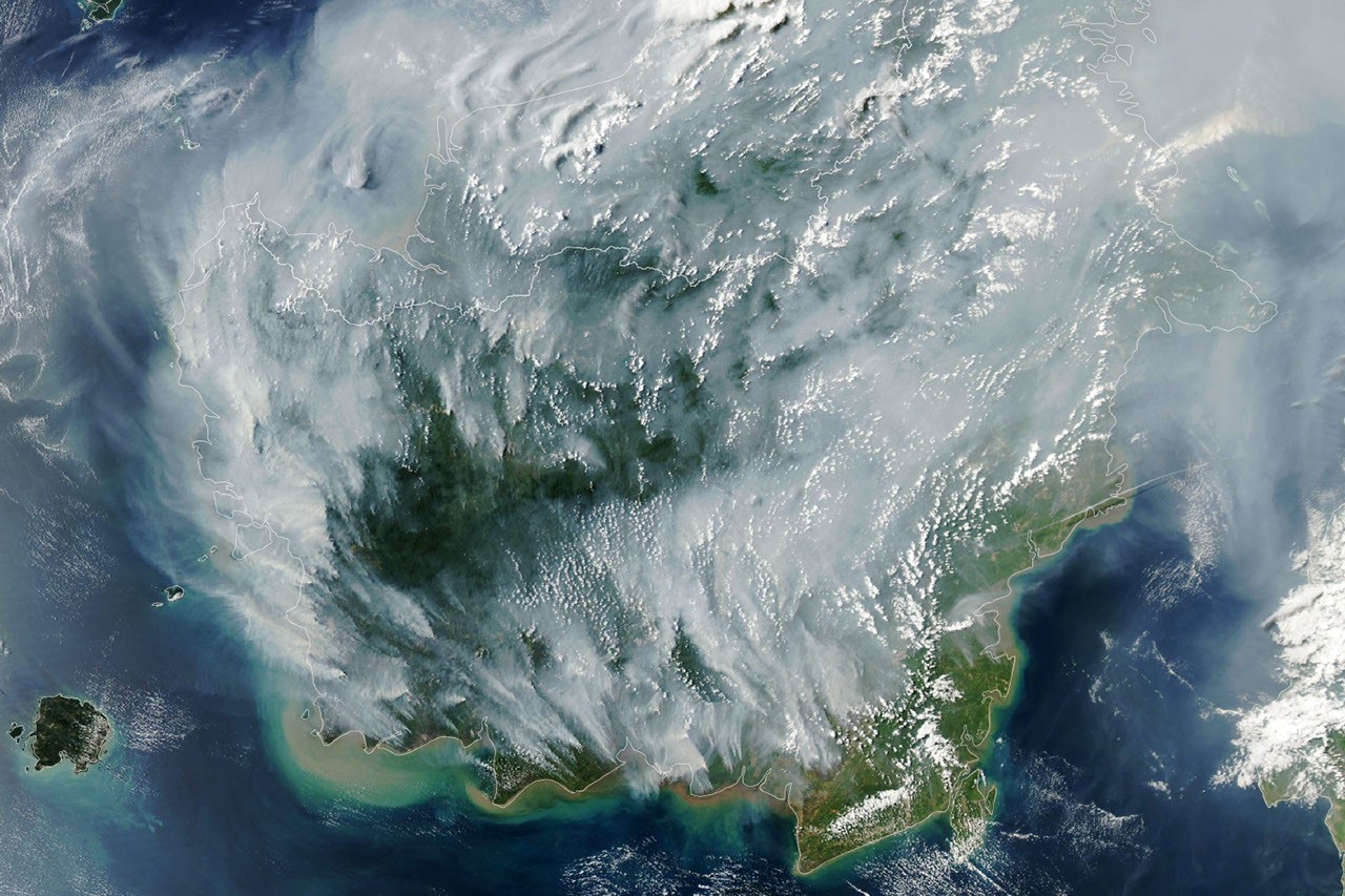
NASA satellite imagery reveals widespread peatland fires across Indonesia as the nation faces severe drought conditions. The fires burn both above and below ground, creating a hazardous situation that extends far beyond Indonesia's borders.
Peatlands store vast quantities of carbon in their soil. When these wetlands burn, they release enormous amounts of carbon dioxide and methane into the atmosphere. Underground fires prove particularly difficult to extinguish because they consume the organic matter beneath the surface, burning for weeks or months with minimal visible flame. These subsurface fires produce dense smoke that blankets entire regions.
The Moderate Resolution Imaging Spectroradiometer (MODIS) instruments aboard NASA's Terra and Aqua satellites detected hotspots across Indonesian peatlands. These thermal sensors identify areas where vegetation and peat burn. During peak fire seasons, satellite data shows hundreds of active fire locations concentrated in Sumatra, Kalimantan, and Papua.
Indonesia's drought stems from the El Niño weather pattern, which shifts rainfall away from Southeast Asia. Peatlands, which normally remain waterlogged and fire-resistant, dry out during extended dry periods. Once dried, peat becomes highly flammable. A single spark ignites fires that penetrate meters into the soil column. Agricultural clearing and land preparation by farmers and companies intensify the problem, as deliberate burning escapes containment during drought years.
The smoke reaches neighboring countries. Malaysia, Singapore, and Thailand experience air quality degradation that affects millions of people. Air quality indices spike into hazardous ranges, triggering respiratory health crises. Schools close, hospitals report surges in asthma and bronchitis cases, and visibility drops to dangerous levels for transportation.
From a climate perspective, Indonesian peatland fires rank among the world's most potent carbon sources. A single severe fire season can release as much carbon as an industrialized nation emits annually. The 2015 peatland fires released approximately 1.6 billion tons of carbon dioxide equivalent, exceeding Indonesia's normal annual emissions. This creates a feedback loop where fire-driven emissions worsen atmospheric conditions, potentially intensifying future droughts.
NASA's satellite monitoring provides critical data for Indonesian authorities and international researchers tracking fire extent, intensity, and progression. The data helps policymakers assess disaster response needs and international smoke impacts. Ground-based observations from Indonesian agencies complement satellite data to guide firefighting operations.
Long-term solutions require peatland restoration. Rewetting degraded peatlands reduces fire susceptibility by raising water tables. Indonesia has committed to large-scale peatland restoration programs targeting millions of hectares. These efforts aim to transform fire-prone, drained peatlands back into carbon-storing wetlands.
Current drought conditions persist across Indonesia. Authorities maintain fire watch protocols. Satellite instruments will continue monitoring hotspots throughout the dry season. The data flows to disaster management agencies, climate researchers, and international environmental organizations tracking one of Earth's most carbon-intensive fire phenomena.