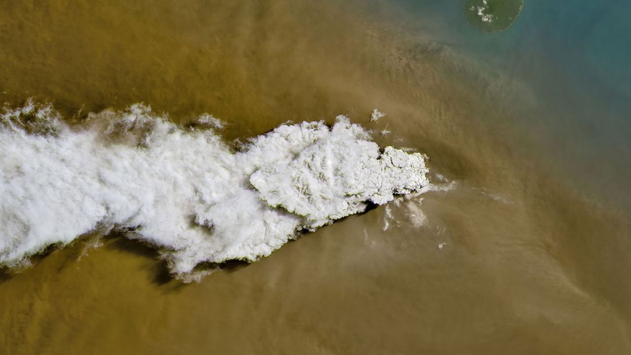
A volcanic eruption in Indonesia last week produced a towering plume visible from orbit, capturing the attention of Earth observation satellites monitoring the planet's geological activity in real time.
Anak Krakatau, located in the Sunda Strait between Java and Sumatra, unleashed an explosive eruption that sent ash and volcanic gases kilometers into the atmosphere. The eruption was dramatic enough that orbital platforms detected and imaged the event as it unfolded. Satellites equipped with high-resolution cameras and thermal sensors tracked the expanding plume, documenting the scale and intensity of the volcanic discharge.
Earth observation satellites serve as critical monitoring tools for volcanic activity worldwide. Instruments aboard platforms operated by NASA, the European Space Agency, and commercial providers can detect thermal signatures from active lava, measure ash column heights, and track aerosol dispersal across vast distances. This orbital vantage point provides volcanologists with real-time data impossible to obtain from ground-based sensors alone, especially in remote or difficult-to-access regions.
Anak Krakatau, whose name means "Child of Krakatau," sits in one of Earth's most volcanically active regions. The volcano forms part of the Pacific Ring of Fire, a zone where tectonic plates collide and generate intense geological activity. The volcano itself emerged from the sea following the catastrophic eruption of its parent volcano, Krakatau, in 1883. That historic eruption killed tens of thousands and produced sound waves detected around the globe.
Modern satellite technology provides unprecedented capabilities for monitoring such hazards. Thermal infrared sensors can penetrate volcanic ash clouds to identify hot lava, while multispectral imaging systems detect the composition of aerosols dispersed into the upper atmosphere. Data collected during eruptions helps scientists understand the mechanics of volcanic processes and assess environmental impacts. Ash dispersal patterns, for instance, can affect air quality across regions and alter atmospheric conditions.
The eruption and its satellite documentation contribute to a growing database of volcanic behavior captured from space. Researchers analyze these observations to refine eruption forecasting models, track long-term trends in volcanic activity, and understand how eruptions influence climate and atmospheric chemistry. Each recorded event adds another data point to humanity's understanding of planetary processes.
Space-based monitoring also serves practical purposes for civil protection. When satellites detect active eruptions, authorities receive timely warnings to issue evacuation orders or issue aviation alerts. Aircraft flying near volcanic regions must avoid ash clouds, which can damage engines and reduce visibility. Orbital data helps aviation authorities establish flight-restricted zones and reroute traffic away from hazardous airspace.
The ability to observe volcanic eruptions from space underscores how satellite technology has become essential infrastructure for planetary monitoring. What once required dangerous field expeditions or remained invisible to science now appears in crystal clarity on screens thousands of kilometers away. As volcanic unrest continues in Indonesia and elsewhere, satellites maintain their constant vigil, documenting eruptions as windows into Earth's dynamic interior.