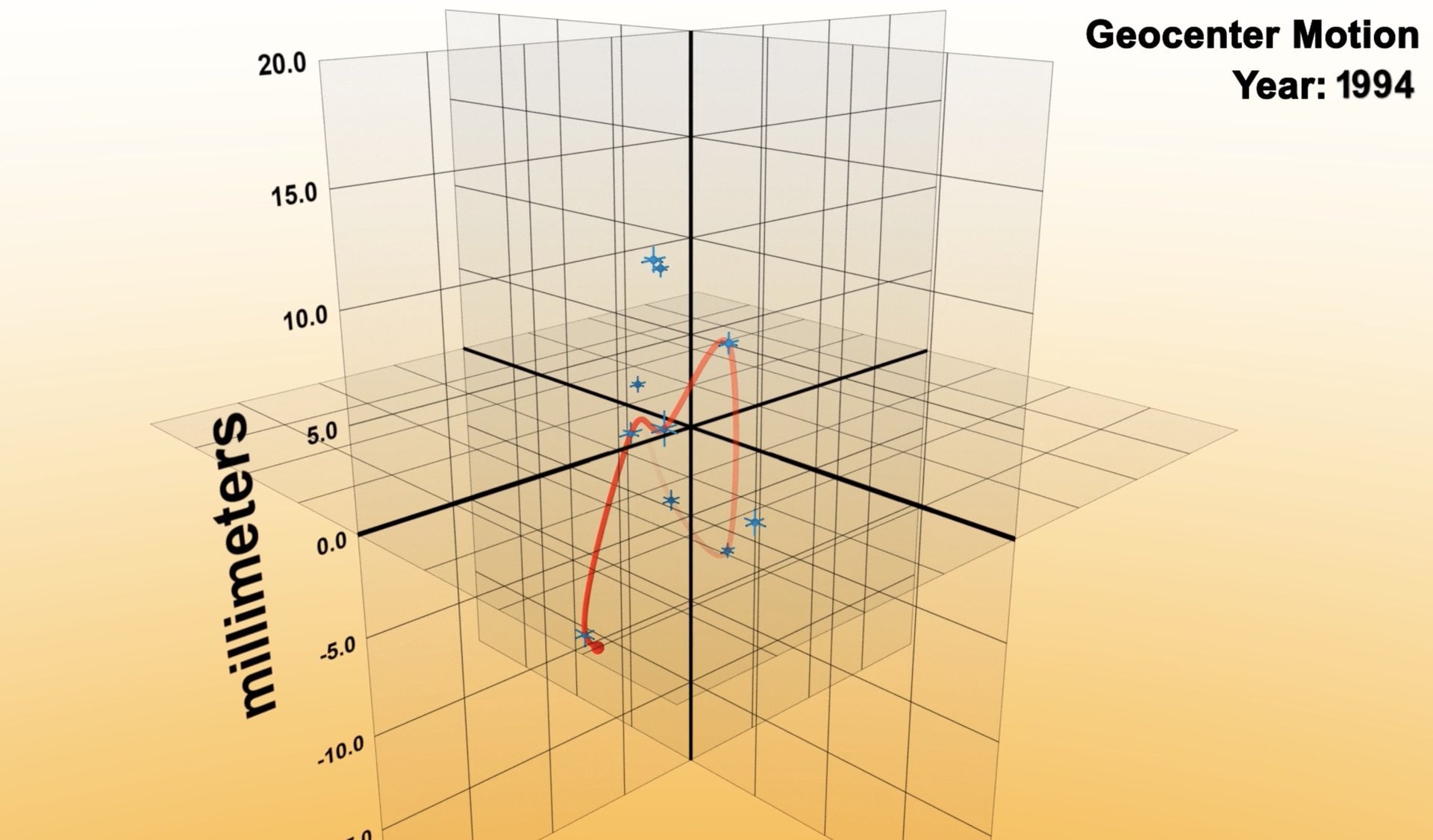
Earth's center of mass, the planet's gravitational balance point, shifts constantly but less dramatically than previous measurements suggested. New research published by NASA scientists quantifies these movements down to millimeter precision and reveals that seasonal variations in the planet's mass distribution produce smaller shifts than earlier estimates indicated.
The center of mass drifts due to redistribution of water and ice across the planet. Seasonal melting and freezing of polar ice sheets, variations in groundwater storage, and shifts in ocean currents all contribute mass movement that nudges Earth's gravitational center. Mountain ranges and dense geological structures also play a role. When water accumulates in aquifers or ice builds up in Antarctica, that mass migrates and tugs the center of mass along with it.
NASA's Jet Propulsion Laboratory and researchers using satellite data from the GRACE mission (Gravity Recovery and Climate Experiment) conducted the analysis. The GRACE satellites measure Earth's gravitational field with extraordinary precision by detecting minute changes in their orbital velocity as they pass over regions of varying density. This technique allows scientists to track mass redistribution across the entire planet and pinpoint where material accumulates and depletes.
Previous studies estimated larger seasonal movements, with some research suggesting drifts exceeding a few centimeters annually. The new analysis narrows these estimates considerably. The finding reflects refined measurement techniques and improved understanding of how water moves through Earth's systems. Researchers cross-referenced GRACE data with hydrological models that track precipitation, evaporation, and runoff to isolate the contributions of different sources.
Quantifying Earth's center of mass matters for navigation, timing, and space mission planning. GPS satellites depend on accurate Earth models to provide location data. Atomic clocks that underpin global telecommunications require precise knowledge of gravitational potential. Space agencies launching missions to orbit or land on other celestial bodies must account for Earth's mass distribution and its changes over time. Even minor discrepancies in center-of-mass calculations compound over years, throwing orbital predictions off target.
The measurements also serve fundamental science. Tracking how and where mass moves reveals planetary systems in action. Rapid ice sheet loss in Greenland and Antarctica shifts the center of mass in measurable ways. Drought-driven depletion of aquifers shifts it another direction. By monitoring these movements at millimeter resolution, scientists build clearer pictures of how climate change physically reshapes Earth's mass distribution and affects the planet's rotation and orientation in space.
The research demonstrates the sophistication of modern space-based geodesy. The ability to measure planetary-scale movements in millimeters from satellites orbiting hundreds of kilometers overhead represents a watershed moment for Earth science. These measurements feed into climate models and long-term sea level predictions. They also constrain models of post-glacial rebound, the slow upward movement of land after ice sheet weight disappears, which continues reshaping landscapes in formerly glaciated regions.