NASA launches an ambitious airborne campaign to measure agricultural pollution across Colorado this year. The FarmFlux mission deploys more than a dozen specialized sensors aboard research aircraft to quantify emissions from farms and ranches that escape direct measurement in current Earth monitoring systems.
The operation targets a blind spot in atmospheric science. Agricultural emissions, particularly from livestock operations and crop management, rank among the largest contributors to air pollution and climate forcing. Yet ground-based networks and satellite instruments capture only fragments of this data. FarmFlux bridges that gap through low-altitude flights that sample the atmospheric boundary layer directly above farming regions.
The sensors measure ozone precursors, methane, ammonia, particulates, and reactive nitrogen compounds. These pollutants form where they're released, in the turbulent zone where farms meet sky. By flying low and slow over agricultural landscapes, NASA scientists collect high-resolution vertical profiles impossible to obtain from space or stationary towers.
NASA's Goddard Space Flight Center in Greenbelt, Maryland leads the effort alongside Colorado institutions. Goddard brings expertise in atmospheric chemistry missions spanning decades. The agency previously flew similar low-altitude surveys over wildfire smoke, urban pollution, and coastal regions. FarmFlux adapts those proven methods to agriculture, a sector that generates roughly 10 percent of U.S. greenhouse gas emissions and significant fractions of ammonia and methane nationwide.
Colorado hosts the campaign for strategic reasons. The state encompasses diverse agricultural zones from high-altitude ranches to irrigated crop valleys. Intensive dairy and feedlot operations cluster in specific regions, creating measurable pollution plumes. Summer conditions produce vigorous atmospheric mixing that carries emissions upward, making them easier to detect and characterize. Spring and fall provide different chemistry regimes, so timing matters for understanding seasonal patterns.
The data feeds multiple purposes. Regulatory agencies use such measurements to refine emissions inventories that inform air quality standards and climate policy. Farmers gain insights into their actual emissions footprint, moving beyond generic calculation models. Atmospheric chemists model how agricultural compounds interact with ozone formation and secondary organic aerosol production. Climate scientists refine forcing estimates for long-lived greenhouse gases leaking from agricultural systems.
FarmFlux also tests sensor technology for future satellite instruments. Existing NASA satellites measure methane globally but lack the resolution and specificity to pinpoint agricultural sources or quantify temporal variability. Airborne validation flights prove which sensor designs work in real conditions and which need refinement before space deployment.
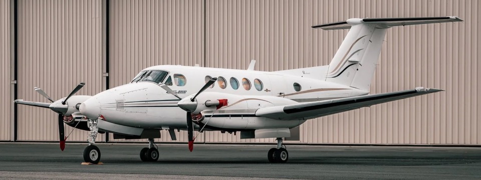
The flights occur at altitudes typically under 2,000 feet, requiring coordination with Federal Aviation Administration clearances and avoiding populated areas. Aircraft used in such campaigns usually include turboprops like the Twin Otter or larger platforms like the C-130. Sensor packages mount on fuselages and wing pods, with real-time data telemetry streaming to ground stations and onboard analysis teams.
Results will appear in peer-reviewed literature within 18-24 months of campaign completion. The data becomes publicly available through NASA's Earth Observing System Data and Information System (EOSDIS), accessible to researchers worldwide. This open-data approach aligns with NASA's Earth science mandate to understand land-atmosphere interactions that affect climate, air quality, and agricultural sustainability.
FarmFlux exemplifies how traditional aircraft remain indispensable for Earth science despite the satellite era. Low-altitude sampling captures phenomena satellites cannot resolve, bridging the gap between point measurements and planetary-scale observations.