# Beneath Greenland's Ice: NASA Maps Reveal a Hidden Valley Network
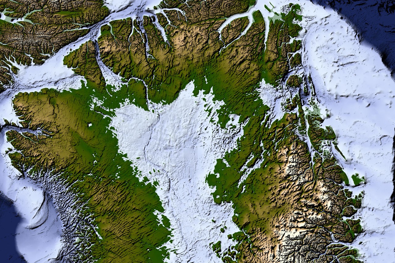
NASA scientists have completed the most detailed map yet of the landscape buried beneath Greenland's ice sheet, revealing an interconnected network of valleys that previous surveys missed or presented as fragmented features. The discovery fundamentally alters our understanding of the bedrock topography underlying one of Earth's largest ice masses.
The new bathymetric map integrates data from airborne surveys, satellite measurements, and ice-penetrating radar to create a comprehensive picture of the terrain two kilometers below the surface. Researchers found that hundreds of valleys form a continuous system rather than isolated features, suggesting that water routing and ice flow dynamics operate differently than previously modeled.
This work matters for multiple reasons. Understanding the architecture of the bedrock beneath Greenland's ice sheet directly informs predictions about how the ice will respond to warming. Meltwater cascades through subglacial valleys and channels, lubricating the base of the ice sheet and accelerating its flow toward the ocean. If these pathways differ from what earlier maps suggested, then current models for future ice loss need revision.
The Greenland Ice Sheet holds enough water to raise global sea levels by approximately 7.4 meters if it melts completely. Over recent decades, the sheet has accelerated its discharge into the North Atlantic and Arctic oceans. Precise knowledge of the subglacial landscape helps glaciologists predict how quickly this process will accelerate and where enhanced melting might occur first.
The research team, working through NASA's Goddard Space Flight Center and partner institutions, combined multiple data sources to pierce through the ice. Radio echo sounding from aircraft surveys provided direct measurements of ice thickness across thousands of flight lines. Satellite gravity data from GRACE and GRACE-Follow-On missions revealed subtle variations in mass distribution. Modern altimetry showed surface topography with unprecedented precision.
One striking finding involves the scale and connectivity of these valleys. Rather than discrete depressions scattered randomly across the bedrock, the team discovered that many valleys link together into drainage systems. Some extend hundreds of kilometers. This configuration suggests that subglacial water doesn't pool randomly but channels into organized flow routes, which fundamentally affects where and how quickly basal lubrication occurs.
The map also reveals previously unknown features like subglacial lakes and ridge systems that could trap or redirect water flow. These details matter for understanding where the ice sheet's base may be sliding fastest and where intervention or monitoring should focus.
The project updates earlier maps compiled over decades by various agencies and research groups. Those efforts, while pioneering, left gaps and contradictions in regions where data coverage remained sparse. The new survey improves spatial resolution significantly and fills in previously ambiguous areas.
This mapping effort feeds directly into ongoing ice-sheet modeling work conducted by NASA's Cryospheric Sciences Laboratory and partner organizations. Climate models now incorporate these refined topographic datasets to produce more accurate predictions of Greenland's future contribution to sea-level rise through the end of this century and beyond.
As Greenland continues warming faster than the global average, detailed knowledge of its subglacial terrain becomes increasingly vital for coastal communities worldwide that face rising oceans.