# Powerful Storms Continue to Prowl the Pacific
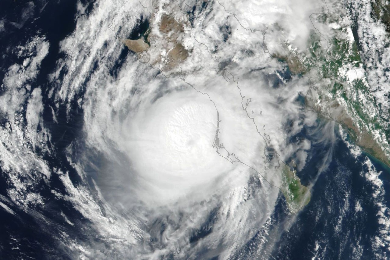
NASA satellites tracked two major hurricanes across the Pacific basin as the 2024 Atlantic and Pacific hurricane season entered a particularly active phase. Hurricanes Polo and Nolo generated destructive weather patterns across the northeastern and central Pacific regions, bringing heavy rainfall, dangerous winds, and coastal hazards to vulnerable areas.
Polo intensified rapidly over warm Pacific waters, leveraging the energy available in the basin's elevated sea surface temperatures. The storm's structure revealed itself clearly in satellite imagery from NASA's Earth observation fleet, which continuously monitors tropical cyclone development. Nolo followed a similar intensification pattern, benefiting from atmospheric conditions that favored rapid organization and sustained strength.
NASA's satellite constellation, including the GOES-West geostationary satellite and polar-orbiting instruments like those aboard the NOAA-NASA Suomi NPP mission, provided real-time data on storm structure, rainfall rates, and wind field evolution. These observations feed directly into operational forecasts issued by the National Hurricane Center and support the infrastructure planning decisions of emergency management agencies across Pacific-facing states and territories.
The 2024 Pacific hurricane season reflected broader climatic patterns. Warm ocean temperatures in the tropical eastern Pacific created favorable conditions for storm formation and intensification. Sea surface temperatures in excess of 28.5 degrees Celsius (83 degrees Fahrenheit) provided the thermal energy hurricanes require to organize and strengthen. Climate data indicates these warm conditions partly resulted from the natural oceanic oscillations of the Pacific, combined with longer-term warming trends in the global ocean baseline.
Storm surge represented a principal threat from both hurricanes. When a cyclone's circulation pushes water toward the coast, the combined effect of the storm tide and normal astronomical tides can inundate low-lying areas. Wind waves driven by hurricane-force gusts added to coastal erosion. Inland, heavy precipitation from slow-moving systems created flooding risks for watersheds already saturated from earlier storms in the season.
The forecast track data released by the National Hurricane Center guided evacuation decisions and preparation protocols. Communities in Hawaii, Mexico, and the southwestern United States monitored the storms' projected paths, adjusting resource deployment and sheltering operations based on the best available science.
For climate and atmospheric scientists, the activity level in 2024 contributed to growing datasets on hurricane behavior in a warming world. Each storm provides new observations about the relationship between ocean heat content, atmospheric dynamics, and cyclone intensity. These datasets inform improved hurricane prediction models and long-term climate projections.
Polo and Nolo represented typical products of the Pacific's active hurricane season. Multiple tropical systems developing simultaneously, rapid intensification events, and sustained strength over warm water reflected conditions observers expect to see more frequently as ocean temperatures continue to rise. The satellite observations and forecast guidance that tracked these storms demonstrated the maturity of modern space-based weather monitoring systems, yet also underscored the persistent challenge of predicting hurricane behavior with complete precision.