# Western Australia's Desert Floor Erupts in Wildflower Blooms After Winter Rains
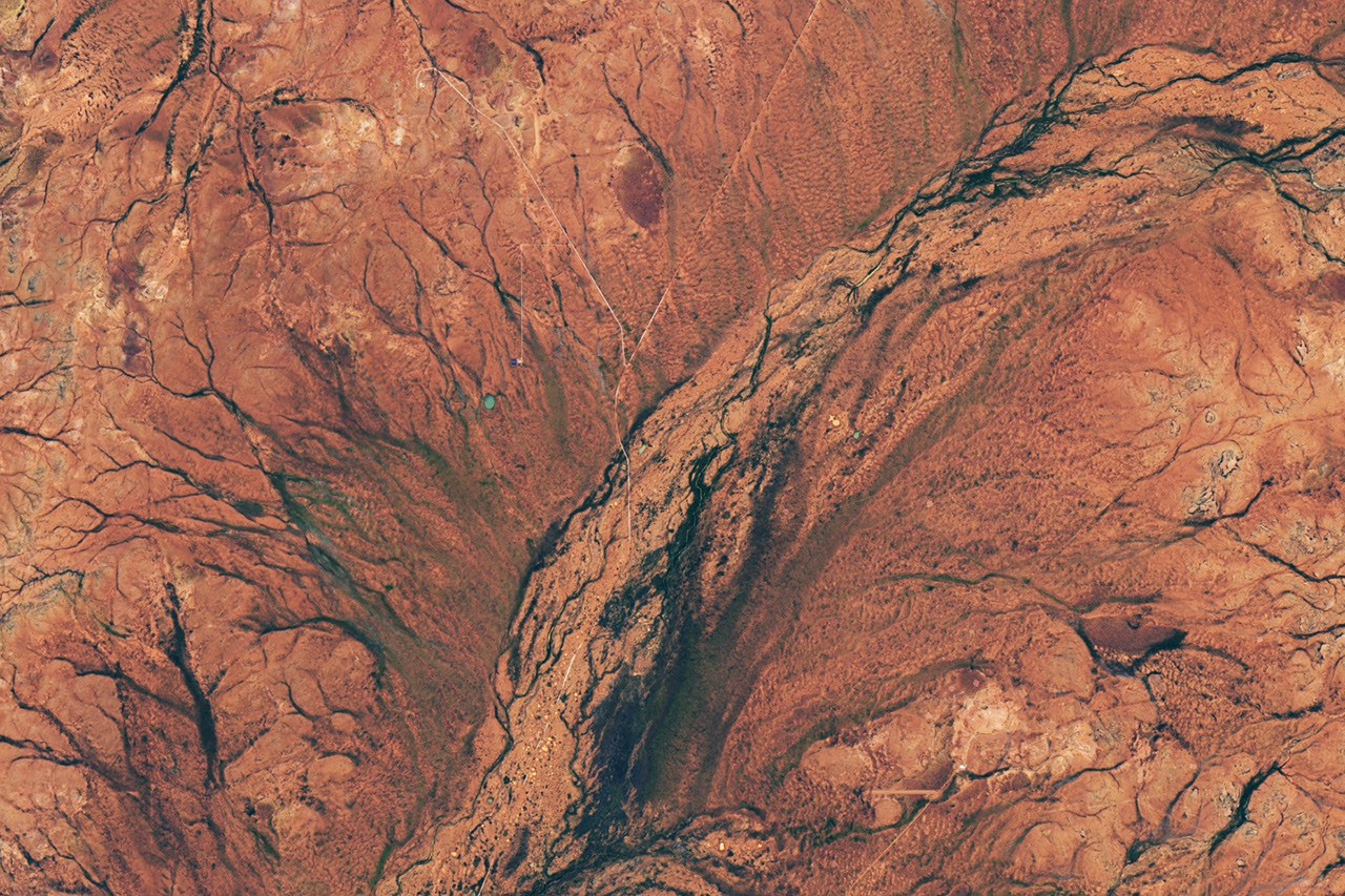
NASA satellites have captured a striking transformation across Western Australia's arid interior. Vast carpets of wildflowers now blanket the ochre-colored desert landscape following winter precipitation, creating a temporary ecosystem explosion that transforms one of Earth's driest regions into a botanical spectacle visible from orbit.
The phenomenon occurs when sufficient rainfall reaches the Australian interior during the winter months, triggering dormant seeds buried in the soil to germinate simultaneously. This synchronized blooming creates dense flower coverage across thousands of square kilometers, painting the desert in vibrant colors that contrast sharply with the barren terrain. NASA's Earth-observing satellites, equipped with multispectral imaging sensors, detect these changes in vegetation cover and surface reflectance, revealing patterns invisible to ground-based observers across such expansive areas.
Western Australia's desert regions experience highly variable precipitation. Most years bring minimal moisture, leaving the landscape in dormancy. Seeds remain viable in the soil for years, waiting for conditions that signal time to grow. Winter rains, typically between June and August in the Southern Hemisphere, occasionally deliver the threshold moisture needed to break germination dormancy. When these conditions align, the desert awakens dramatically.
This year qualifies as a boom year for wildflower coverage. The extent and density of flowering across Western Australia's interior exceeds typical years, indicating favorable precipitation patterns combined with ideal growing temperatures. NASA's remote sensing data documents these variations over time, creating a valuable record of how arid ecosystems respond to climate variability. Scientists use satellite observations to track vegetation dynamics across regions where ground surveys prove logistically difficult or impossible.
The ecological importance extends beyond visual spectacle. These wildflower blooms support pollinator populations, provide food sources for herbivores, and contribute nutrients to the soil through plant biomass. The temporary pulse of primary productivity ripples through the food web, benefiting species adapted to exploit these predictable but infrequent resource abundances. Desert creatures from insects to kangaroos time reproductive cycles around these blooming events.
Remote sensing of vegetation provides Earth scientists with tools to monitor ecosystem health and responsiveness to environmental change. By measuring spectral reflectance across visible and infrared wavelengths, NASA instruments calculate vegetation indices that quantify plant biomass and chlorophyll content. These measurements enable researchers to distinguish between bare soil and vegetated areas, track seasonal changes, and identify anomalies like unusually extensive blooming years.
Western Australia's interior represents a region where human presence remains sparse, making satellite observation the practical method for monitoring conditions across vast distances. NASA's suite of Earth-observing missions, including Landsat and the Moderate Resolution Imaging Spectroradiometer (MODIS), continuously scan the planet's surface. This archived imagery enables time-series analysis showing how desert ecosystems fluctuate in response to precipitation cycles.
The wildflower bloom event illustrates how Earth observation satellites contribute to understanding terrestrial ecosystem dynamics. These tools reveal patterns and scales of environmental change that would otherwise remain undocumented, providing baseline data for tracking how climate variability affects arid regions globally.