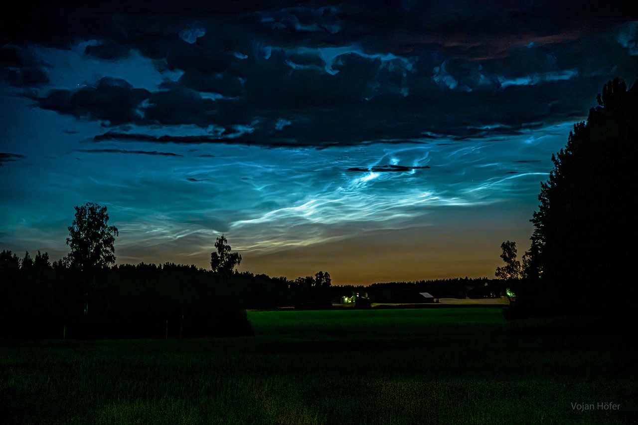
# Noctilucent Clouds Frame the Upper Atmosphere in Rare Swedish Display
Noctilucent clouds captured the sky over Sweden in October 2026, offering observers a glimpse into one of Earth's highest cloud formations and revealing clues about atmospheric conditions at the mesosphere. These luminescent ice crystal clouds form at altitudes between 76 and 85 kilometers, well above the troposphere where everyday weather occurs.
Noctilucent clouds remain visible after sunset because they occupy altitudes high enough to catch sunlight even when the ground lies in darkness. The Sun illuminates these clouds from below the horizon, creating their distinctive silvery-blue glow. This optical phenomenon occurs only during twilight hours in high-latitude regions, particularly between late spring and early autumn in polar and near-polar locations.
NASA's Astronomy Picture of the Day program featured this Swedish observation as part of its ongoing documentation of atmospheric phenomena. The APOD project, which has operated continuously since 1995, enlists professional astronomers and citizen observers worldwide to capture and explain daily images of Earth and space. This democratization of astronomical observation has helped build understanding of how our planet interacts with the surrounding cosmos.
The Swedish sighting holds scientific value beyond its visual appeal. Noctilucent cloud frequency and altitude have been rising over recent decades, a trend linked to atmospheric composition changes. Water vapor concentrations in the mesosphere appear to be increasing, possibly due to methane oxidation at high altitudes. These clouds serve as tracers of upper atmospheric conditions and may indicate climate system responses occurring at extreme altitudes.
Formation of noctilucent clouds requires specific conditions. Temperature at the mesosphere must drop to approximately minus 120 degrees Celsius, cold enough for water ice to crystallize despite the extremely thin atmosphere. Dust particles from meteorite ablation provide nucleation sites for ice crystal formation. Wind patterns and gravity waves influence the distinctive rippled and herringbone textures observers frequently report.
October timing for the Swedish observation aligns with the seasonal window when noctilucent clouds become observable at high northern latitudes. The phenomenon occurs most reliably during May through August in the Northern Hemisphere and November through February in the Southern Hemisphere. The October date suggests either unusually favorable conditions or the tail end of the northern season when displays remain possible but less common.
Researchers monitor noctilucent clouds through ground-based observation networks and satellite instruments. NASA's Aeronomy of Ice in the Mesosphere missions have provided decades of continuous data on these clouds, their altitude trends, and composition. This combination of amateur observations like the Swedish images and professional satellite data creates a comprehensive record of mesospheric behavior.
The visual documentation of noctilucent clouds supports broader atmospheric science efforts. Understanding cloud formation at extreme altitudes helps researchers model how the atmosphere responds to long-term chemical and thermal changes. These icy filaments at the edge of space represent a direct visual link between ground-based climate processes and the rarefied upper atmosphere where solar radiation and atmospheric chemistry converge.