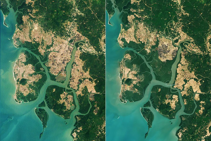
Scientists using Landsat satellite imagery found that mangrove forests worldwide began recovering around 2010 after decades of decline. Between 1984 and 2010, mangroves lost nearly 3,000 square kilometers. Since 2010, they have gained nearly 2,000 square kilometers, with expansion led by Asia, Australia, and South America.
Zhen Zhang, an environmental scientist at Tulane University, analyzed Landsat data collected between 1984 and 2023. "About two-thirds of the expansion was due to mangroves colonizing new areas and the other third due to restoration and regrowth in degraded areas," Zhang said.
Southeast Asia experienced one of the most notable reversals. Burma (Myanmar) lost mangroves rapidly in the 1980s and 1990s due to agriculture, aquaculture, and firewood harvesting. The trend reversed around 2010. Researchers attribute the turnaround to increased awareness and restoration efforts following the 2004 Indian Ocean tsunami, strengthened legal forest protections, and high sedimentation rates that created new mudflats for colonization. Since 2010, Burma's mangrove area has grown about 10 percent.
Mangrove forests store up to four times as much carbon as taller inland tropical forests and protect coastal communities from erosion and storm surges. Their stilt-like roots provide habitat and nursery grounds for fish, shrimp, crabs, and other marine life.
Warming temperatures and fewer freezes have allowed mangroves to expand into previously too-cold areas at the northern and southern edges of their range, including the southeastern United States. Extensive sediment deposition has created new mudflats in areas such as around the Amazon River mouth and northern Australia.
Some regions have seen losses outweigh gains. West and Central Africa experienced substantial mangrove losses in the Niger Delta since 2010. North America and southern Africa have seen widespread degradation after tropical cyclones devastated mangrove areas.