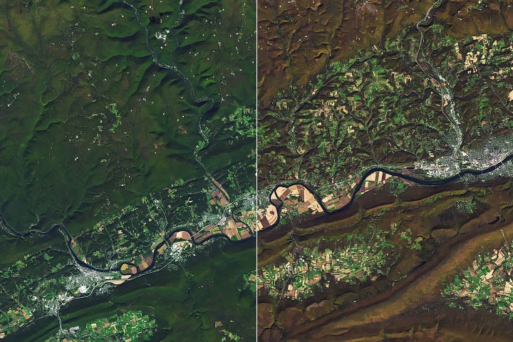
The Operational Land Imager on NASA-USGS Landsat 8 captured images of Pine Creek Gorge in north-central Pennsylvania on October 9 and October 25, 2026, showing the progression of fall foliage across the landscape. The gorge, nicknamed the "Grand Canyon of Pennsylvania," reaches depths of about 1,500 feet (460 meters) and runs for some 45 miles from Ansonia south to Pine Creek's confluence with the West Branch Susquehanna River.
Glaciers shaped the canyon indirectly. During the last ice age, glaciers advancing from the northeast dammed Pine Creek, which originally flowed north. The resulting lakes overflowed southward, and when the ice receded, glacial meltwater continued carving the valley deeper while sediment prevented the river from reversing its course. Today, northern hardwood and mixed oak forests, sprinkled with hemlock and white pine, cover the hillsides.
The area endured heavy logging in the 19th century. White pine trees several feet in diameter were felled for ship masts, and hemlock bark was harvested for leather tanning. Log drives down Pine Creek to the Susquehanna continued until railroads arrived. By the early 20th century, the landscape had become so denuded it earned the name "Pennsylvania Desert."
The forest has returned. In 1968, an area of 30,000 acres was designated a National Natural Landmark. Black bears, coyotes, bobcats, timber rattlesnakes, and diverse songbirds now inhabit the gorge, which visitors can explore through multiple state parks and the Pine Creek Rail Trail.