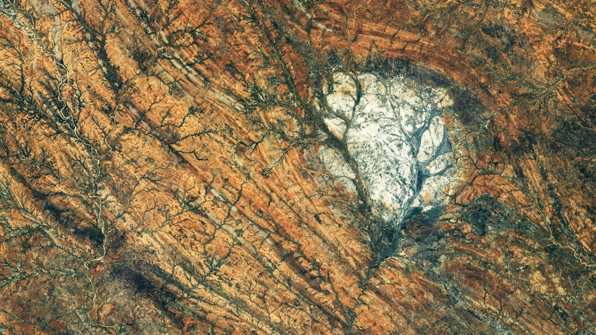
An astronaut aboard the International Space Station photographed the Saririaky anorthosite massif in southern Madagascar on August 28, 2026. The formation covers roughly 100 square kilometers and consists of anorthosite, an igneous rock that dominates the Moon's bright highlands.
Anorthosite forms when molten rock cools and solidifies beneath Earth's surface, allowing minerals to develop into large crystals. The Saririaky formation originated during the late Precambrian, at least 600 million years ago. Geological research shows it stands out visually from the heavily deformed rocks surrounding it.
The massif lies within a ductile shear zone, where intense deformation reshaped rocks deep within Earth's crust. Scientists believe this transformation occurred as ancient landmasses collided during the formation of Gondwana, the supercontinent that eventually included Africa, India, Madagascar, Australia, and Antarctica. Long, roughly parallel geological features extending north to south record this powerful deformation.
A second anorthosite massif located approximately 60 kilometers north of Saririaky lies within the same shear zone. Some researchers suggest the two formations were once connected and were separated by tectonic forces through a process called boudinage, where a strong rock layer is pulled into separate segments.
The Moon's anorthosite-rich highlands exceed 4 billion years old. Scientists believe these rocks formed early in lunar history when a molten magma ocean covered much of the young Moon. As the magma cooled, minerals crystallized near the surface and helped form the Moon's early outer crust. Apollo astronauts returned lunar anorthosite samples to Earth, but limited quantities make terrestrial formations valuable for comparison. The Saririaky massif offers researchers another example of geological similarities between Earth and the Moon.